🌾 Offline-first field scanner

Point your camera at a field.
Know what to plant.

CropAI reads your GPS location and pulls regional soil, weather, and solar data on the spot β€” then recommends the crop that fits, right over a live camera view of your field.

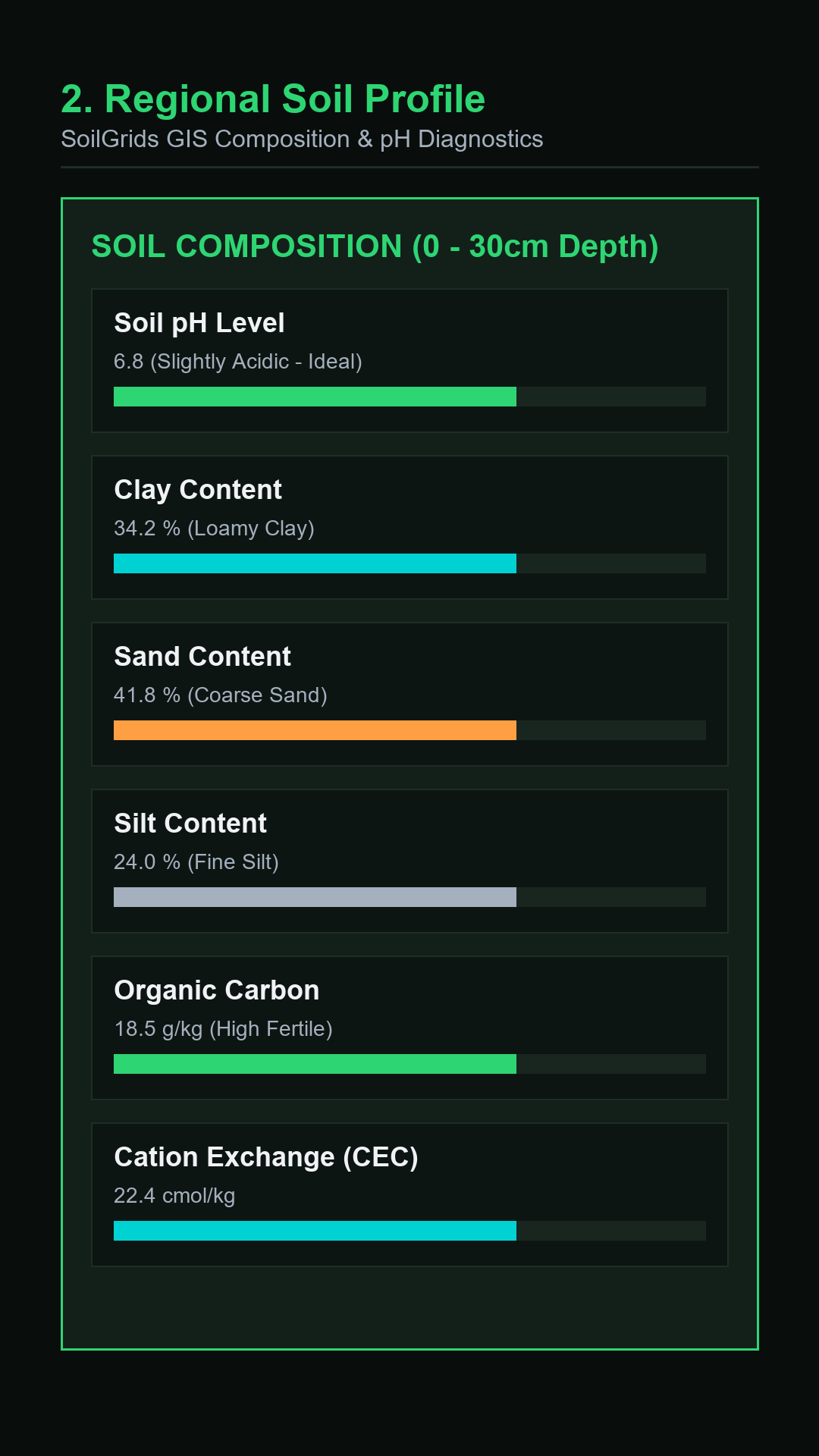
CropAI live field scan HUD CropAI soil and weather data card CropAI crop recommendation CropAI saved scan history
Features

Everything happens at your coordinates

No lab kit, no waiting. CropAI queries public agricultural datasets for exactly where you're standing.

πŸ“·

Live field HUD

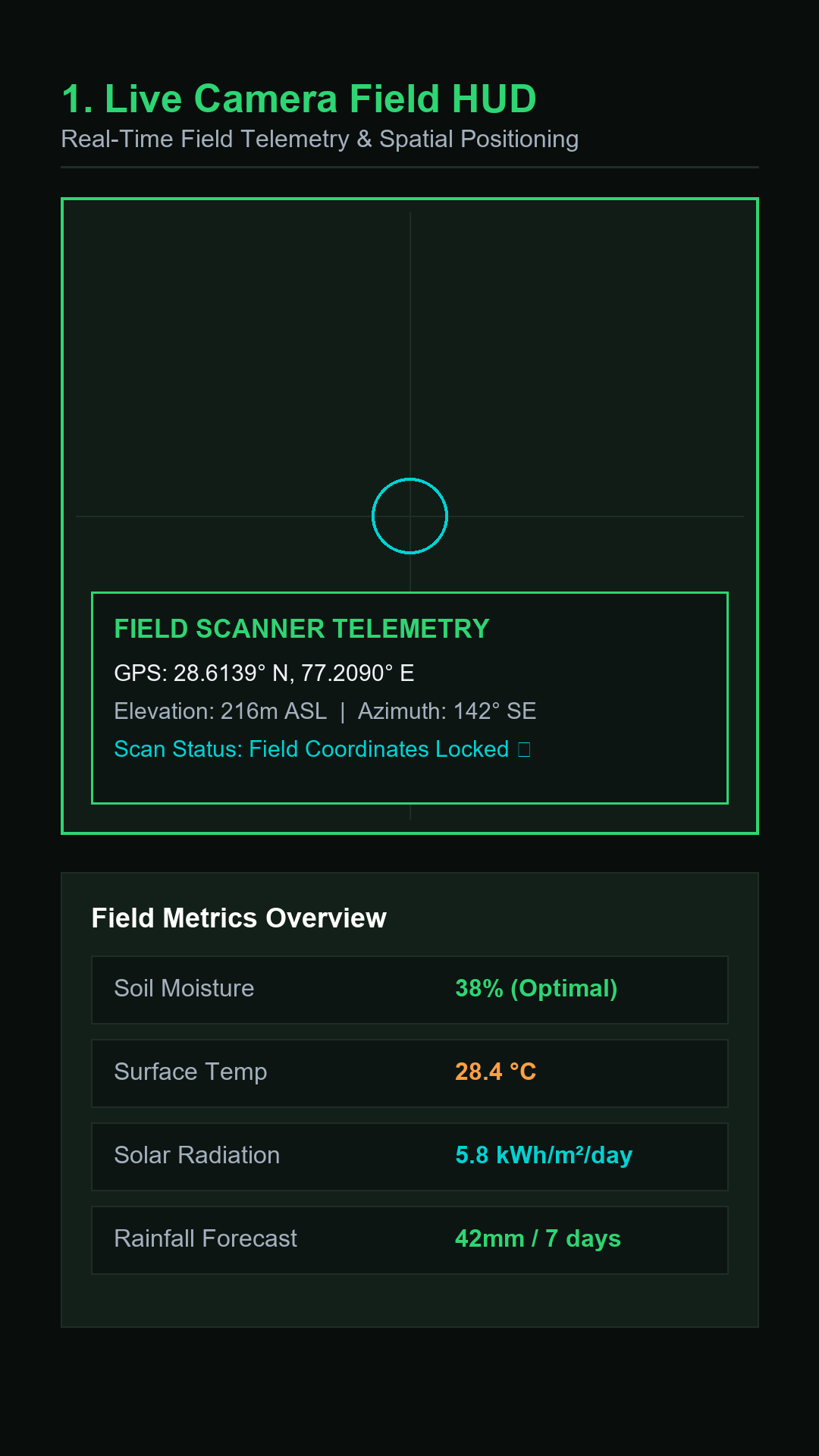
A real-time camera view with a floating data card overlay β€” soil, weather, and crop fit, at a glance.

🧭

GPS-anchored data

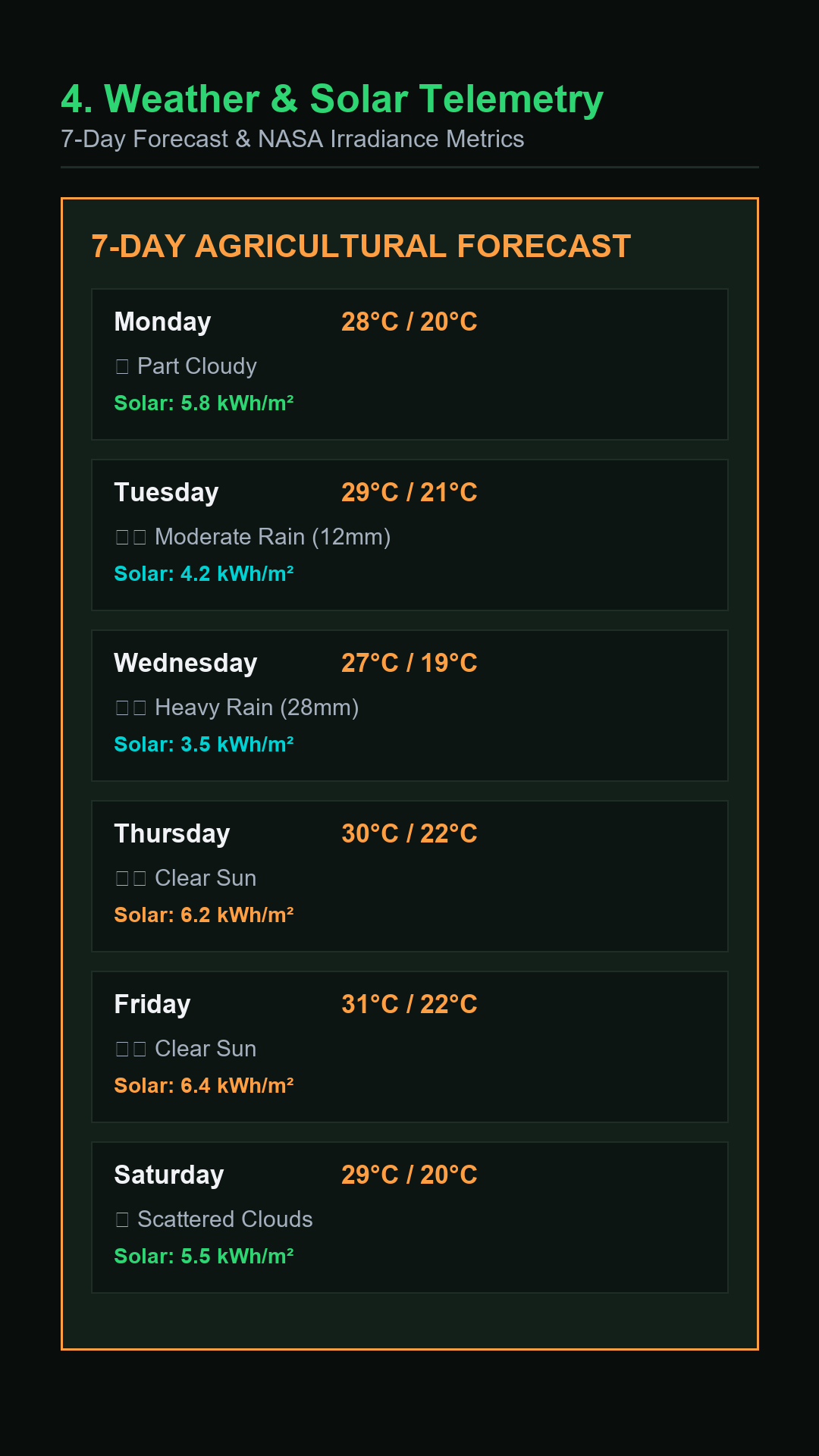
Soil pH, texture, and carbon; 7-day rainfall and temperature; solar irradiance β€” all pulled for your exact spot.

🌾

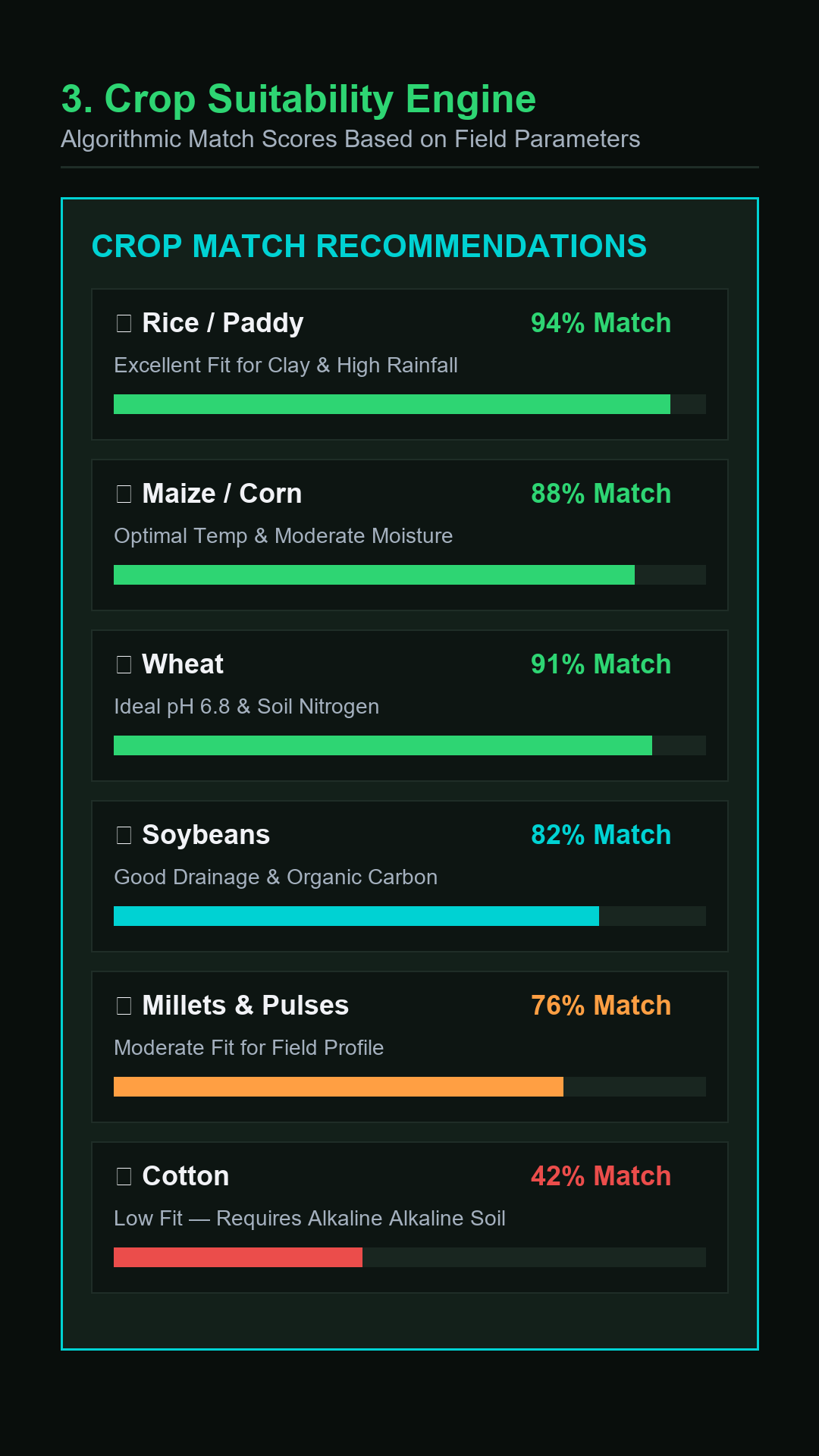
Crop-fit recommendation

An algorithmic match against soil and climate conditions, with the reasoning shown, not just a name.

πŸ“‘

Offline-first

Scans save to your device immediately. No signal, no problem β€” everything syncs when you're back online.

πŸ”

Secure Cloud Backup

Register with your phone number + PIN to access the field scanner and enable automatic cloud backups for restore.

πŸ—ΊοΈ

Offline field map

A cached map view of your saved scan locations, viewable without a connection.

πŸ“„

Exportable reports

Generate a shareable PDF field summary or a CSV log of every scan you've saved.

🌐

Multi-language UI

English, Hindi, Punjabi, Marathi, Telugu, Tamil, French, and Spanish.
How it works

Four steps, no equipment

STEP 1

Open the camera

Point your phone at the field. CropAI shows a live scanning overlay while it works.

STEP 2

It reads your location

GPS coordinates (or a manually entered lat/lon) anchor every data query to that spot.

STEP 3

Data streams in

Regional soil, 7-day weather, and solar data populate the HUD card in seconds.

STEP 4

Save or export

Keep the scan locally, back it up to your account, or export a PDF/CSV report.