📷
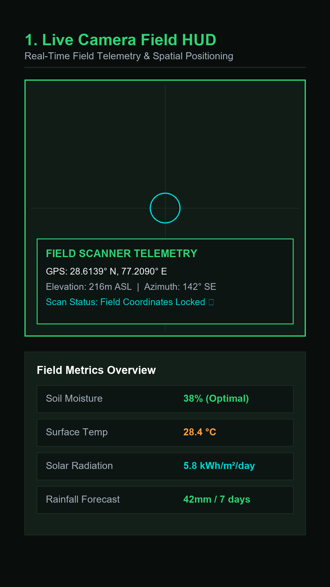
Live field HUD
A real-time camera view with a floating data card overlay — soil, weather, and crop
fit, at a glance.
🧭
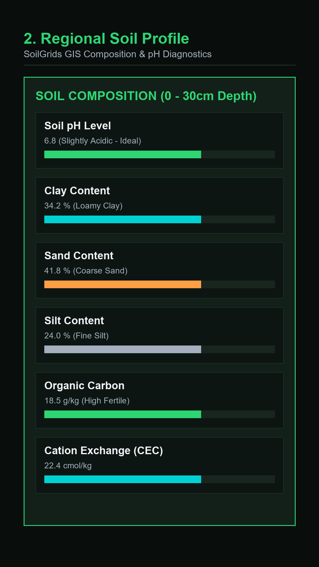
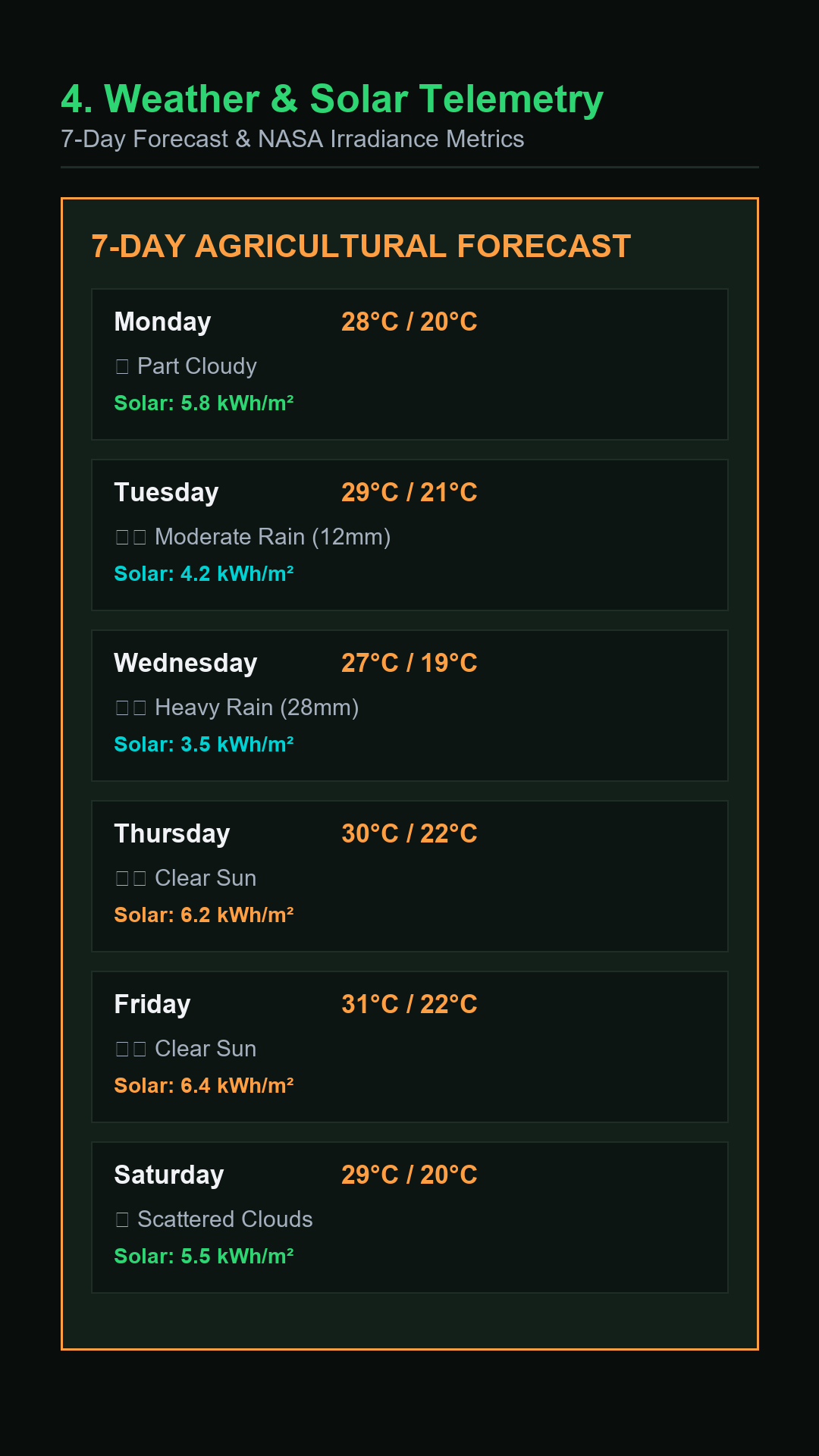
GPS-anchored data
Soil pH, texture, and carbon; 7-day rainfall and temperature; solar irradiance — all
pulled for your exact spot.
🌾
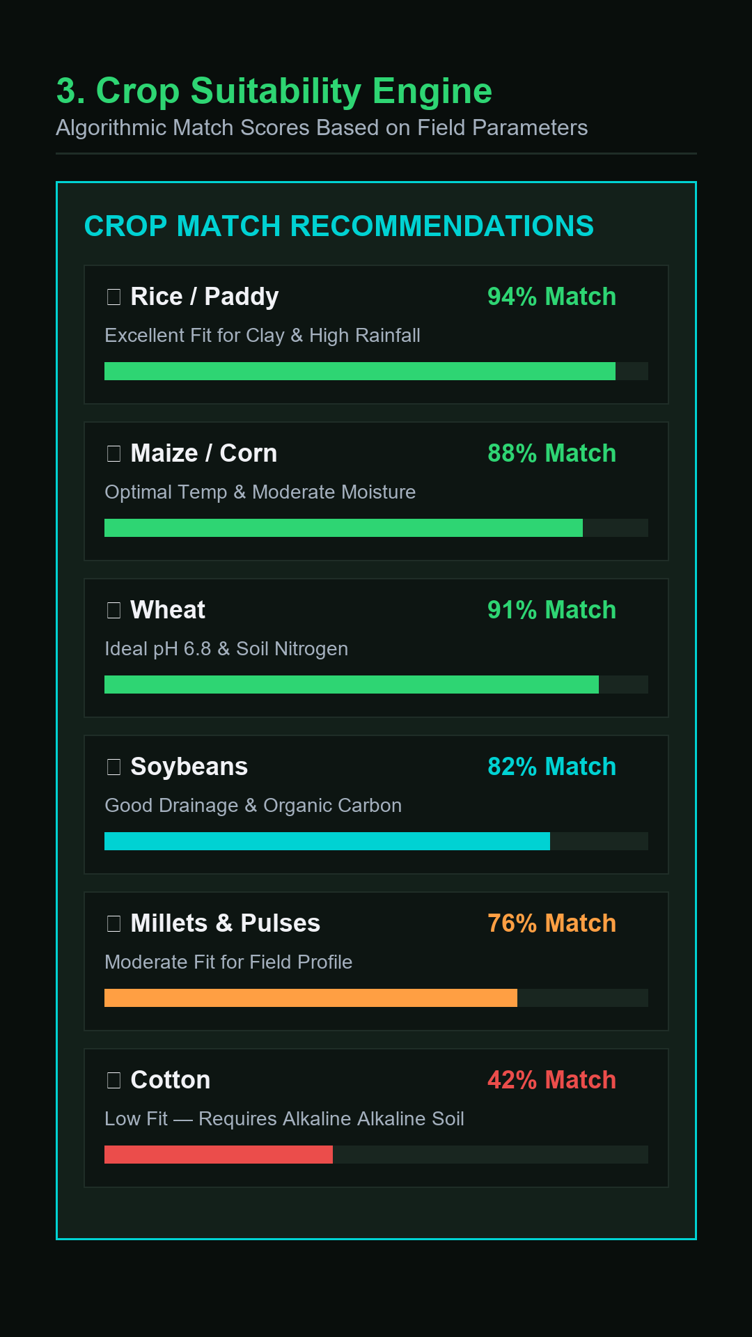
Crop-fit recommendation
An algorithmic match against soil and climate conditions, with the reasoning shown,
not just a name.
📡
Offline-first
Scans save to your device immediately. No signal, no problem — everything syncs when
you're back online.
🔐
Secure Cloud Backup
Register with your phone number + PIN to access the field scanner and enable automatic cloud backups for restore.
🗺️
Offline field map
A cached map view of your saved scan locations, viewable without a connection.
📄
Exportable reports
Generate a shareable PDF field summary or a CSV log of every scan you've saved.
🌐
Multi-language UI
English, Hindi, Punjabi, Marathi, Telugu, Tamil, French, and Spanish.